
Agriculture & Irrigation
To grow their fullest potential, our Geospatial mapping services have been helping farmers and the Indian agriculture industry. GIS mapping solutions also helps to get accurate information about an agricultural landscape
Brainfuel Solutions offers world-class solutions for Geospatial Mapping services to our clients
Brainfuel is one of the leading GIS mapping companies; with its proven expertise has assisted big brands to develop dynamic GIS mapping solutions or digital mapping solutions and open source geospatial mapping services.

Our Geospatial mapping services help our clients to reach their common goal to gain actionable intelligence from all types of data. We are one of the best GIS mapping companies with a strong team of young GIS specialists. We have experience with data conversion, spatial modeling, web-map design, cartography, and Mapping. We’ve helped our clients to capture, store, manipulate, and analyze geospatial data so that it can be used to combine database, mapping and statistical methods to integrate georeferenced data for data collection, processing, and management.
BrainFuel Technologies is an innovative GIS mapping company who strives at providing the best Geospatial mapping solutions. Our GIS mapping solutions are for everyone, whether it is an upcoming business or a multinational corporation. Our expertise with working on GIS ranges from small businesses to government institutions. Brainfuel geospatial mapping services focus on scalability, which in turn helps the unlocking of additional features according to the demand and operational needs.

Our GIS mapping company offers digitization services such as complete CAD conversion, CAD Drafting, and paper to CAD Conversions. With the help of paper to CAD conversions, we can also convert paper drawings and maps into highly digital files
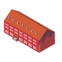
3D Building Landmarks and Photorealistic 3D Models are a unique amalgamation of geo-informatics and multimedia technology that our GIS mapping company creates for monuments, museums, places of worship, recreational destinations, petrol pumps, and other establishments.

Our GIS mapping company creates indoor building plans for building worldwide since the smartphone users now expect the indoor plan of all the buildings to be a click away.

Using Geospatial mapping services, navigation mapping assists the navigation content providers. Our GIS mapping company offers mapping of steel and road network, street digitization, 2D footprints, and 3D Landmarks. Surveys include building a survey, engineering surveys, real estate surveys, and ordnance surveys

Our GIS mapping company enhance cadastral mapping for the creation of cadastral maps from hard copies of the administrative maps which include specific details about plots, roads, railway lines, water bodies, and vegetation

To create comprehensive topographic maps we are using topographic mapping services.

Our MERN stack Development Company use extensive knowledge and experience to develop robust, scalable and efficient CMS for your business

Our GIS mapping company provide GIS data capture services that are used for capturing electrical power networks and navigation data for easy navigation.
To grow their fullest potential, our Geospatial mapping services have been helping farmers and the Indian agriculture industry. GIS mapping solutions also helps to get accurate information about an agricultural landscape

Geospatial mapping services is the key to making better decisions in order to achieve the objective. Our GIS mapping company provides complete solutions for railway networks and asset mapping

For telecom industries, GIS offers a variety of services by providing accurate land base maps and mapping their optical access network

Geospatial mapping services is used by Urban Local Bodies like Municipal Corporations, Municipal Councils, and Municipal Committees to manage their property records and fast-track taxation processes

GIS mapping company recognize the usage and advantage of geospatial technology to most of the industries thus enables businesses across verticals.

Using Geospatial mapping service our team is capable of developing mineral exploration potential. It is also an important planning tool to find mineral potential under the ground
Looking for the best GIS mapping company In India? We guarantee you custom GIS mapping solutions as and when called upon. Discuss your project with us
To make topographic maps by imagery and terrain analysts in trafficability, the stereographic pairs of aerial photographs have often been used
Radiometers and photometers are used for collecting reflected and emitted radiation in a wide range of frequencies
This type of imaging produces an image where each pixel has full spectral information with imaging narrow spectral bands
LIDAR is used mostly to detect and measure the concentration of various chemicals in the atmosphere. The principal application of LIDAR is vegetation remote sensing
They can map features on the seafloor to a resolution of a mile by measuring the bulges of water caused by gravity
Our GIS mapping developers work in a partnering approach with clients, and we love to see the project not as a job to be done, but as a cause, we will invest in.
Being the best GIS mapping Company in India, we integrate the best practices during implementation with a consulting approach to the process
Our GIS mapping Company use robust implementation methodology to deliver and make sure the best value for money and faster ROI.
Our team of highly experienced GIS mapping consultants brings true value to customers and helps achieve higher return on investments through a consulting approach by handling amy requirements proposed by the client.